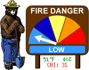
Current Fire Danger
 Forecast Discussion for BOX NWS Office
579
FNUS51 KBOX 202010
FWFBOX
Fire Weather Planning Forecast for Southern New England
National Weather Service Boston/Norton MA
409 PM EDT Sun Apr 20 2025
.DISCUSSION...
**Low Humidity and Breezy Conditions Through This Evening**
This evening will see continued breezy conditions early before
winds drop off considerably overnight. Winds will start between
15 and 25 mph with gusts up to 30 mph early. Minimum relative
humidity values fall into the 15 to 25 percent range inland, and
30 to 45 percent across the Cape and Islands.
Dry conditions Monday with light S to SE winds. Minimum relative
humidities in the 20-30 percent range for the interior and
30-50 percent range for the Cape/Islands and closer to the coast.
Relative humidity values will likely rise later in the afternoon
and overnight Chance of showers Monday night into Tuesday with
light amounts expected.
.OUTLOOK...Tuesday through Friday...
Seasonably mild next week, with temperatures running near to
slightly above normal. Next chance for rainfall comes Friday with
light amounts possible.
MAZ015-210800-
Suffolk MA-
Including the cities of Boston, Chelsea, Revere, and Winthrop
409 PM EDT Sun Apr 20 2025
Tonight Mon Mon Night Tue
Cloud Cover Mclear Mclear Mcldy Pcldy
Precip Type None None Showers Showers
Chance Precip (%) 10 60 50
Chance of Thunder (%) 0 0 0 0
Temp (24h trend) 36 (-18) 61 (0) 48 73
RH % (24h trend) 61 (-17) 23 (+4) 83 45
20ft Wnd AM(mph) Lgt/Var S 5
20ft Wnd PM(mph) NW 9 G22 SE 7 S 7 SW 7
Precip Amount 0.00 0.00 0.10 0.04
Precip Duration 4 1
Precip Begin 9 PM Continuing
Precip End Continuing 3 PM
Mixing Hgt (ft-AGL) 410 3310 950 5120
Transport Wnd (kts) NW 8 SE 6 S 15 W 18
Vent Rate (kt-ft) 3280 19860 14250 92160
Max ADI Early 52 Gen Good 19 Gen Poor 33 Fair 25 Fair
Max ADI Late 7 Poor 27 Fair 13 Gen Poor 25 Fair
Max LVORI Early 2 2 4 4
Max LVORI Late 2 2 4 4
Min Vsby Early 10 10 9 3 Fog
Min Vsby Late 10 9 6 Fog 9
Sunshine Hours N/A N/A N/A N/A
CWR 0 0 80 80
Remarks...None.
.FORECAST FOR DAYS 3 THROUGH 7...
.TUESDAY NIGHT...Partly cloudy. Lows in the upper 40s. West winds
5 to 10 mph.
.WEDNESDAY AND WEDNESDAY NIGHT...Partly cloudy. Lows in the mid
40s. Highs in the mid 60s. Northwest winds 5 to 10 mph.
.THURSDAY...Sunny. Highs in the mid 60s. Northwest winds around
5 mph, becoming southeast in the afternoon.
.THURSDAY NIGHT...Partly cloudy. Lows in the upper 40s. South
winds 5 to 10 mph.
.FRIDAY...Partly sunny. Highs in the upper 60s. South winds 5 to
10 mph.
.FRIDAY NIGHT AND SATURDAY...Mostly cloudy with a chance of
showers. Lows in the lower 50s. Highs in the upper 60s. Southwest
winds 5 to 10 mph.
.SATURDAY NIGHT...Mostly cloudy with a chance of showers. Lows in
the mid 40s. Northwest winds 5 to 10 mph.
.SUNDAY...Mostly sunny. Highs in the upper 50s. Northwest winds
5 to 10 mph.
$$
MAZ016-210800-
Eastern Norfolk MA-
Including the cities of Braintree, Milton, Quincy, and Weymouth
409 PM EDT Sun Apr 20 2025
Tonight Mon Mon Night Tue
Cloud Cover Mclear Mclear Mcldy Pcldy
Precip Type None None Showers Showers
Chance Precip (%) 10 60 50
Chance of Thunder (%) 0 0 0 0
Temp (24h trend) 35 (-18) 61 (0) 46 72
RH % (24h trend) 56 (-20) 24 (+5) 86 47
20ft Wnd AM(mph) Lgt/Var S 6
20ft Wnd PM(mph) NW 8 G21 SE 6 S 7 SW 6
Precip Amount 0.00 0.00 0.10 0.05
Precip Duration 4 1
Precip Begin 10 PM Continuing
Precip End Continuing 4 PM
Mixing Hgt (ft-AGL) 360 4030 970 4720
Transport Wnd (kts) NW 7 S 9 S 16 W 15
Vent Rate (kt-ft) 2520 36270 15520 70800
Max ADI Early 44 Gen Good 17 Gen Poor 28 Fair 25 Fair
Max ADI Late 7 Poor 41 Gen Good 13 Gen Poor 25 Fair
Max LVORI Early 2 2 4 4
Max LVORI Late 2 2 4 4
Min Vsby Early 10 10 9 3 Fog
Min Vsby Late 10 9 6 Fog 9
Sunshine Hours N/A N/A N/A N/A
CWR 0 0 80 80
Remarks...None.
.FORECAST FOR DAYS 3 THROUGH 7...
.TUESDAY NIGHT...Partly cloudy. Lows in the mid 40s. West winds
5 to 10 mph.
.WEDNESDAY AND WEDNESDAY NIGHT...Partly cloudy. Lows in the mid
40s. Highs in the mid 60s. Northwest winds 5 to 10 mph.
.THURSDAY...Sunny. Highs in the mid 60s. Northwest winds around
5 mph, becoming southeast in the afternoon.
.THURSDAY NIGHT...Partly cloudy. Lows in the upper 40s. South
winds 5 to 10 mph.
.FRIDAY...Partly sunny. Highs in the upper 60s. South winds 5 to
10 mph.
.FRIDAY NIGHT AND SATURDAY...Mostly cloudy with a chance of
showers. Lows in the lower 50s. Highs in the mid 60s. Southwest
winds 5 to 10 mph.
.SATURDAY NIGHT...Mostly cloudy with a chance of showers. Lows in
the mid 40s. Northwest winds 5 to 10 mph.
.SUNDAY...Mostly sunny. Highs in the upper 50s. Northwest winds
10 to 15 mph.
$$
MAZ013-210800-
Western Norfolk MA-
Including the cities of Bellingham, Dedham, Foxborough, Medfield,
Norwood, Stoughton, and Wellesley
409 PM EDT Sun Apr 20 2025
Tonight Mon Mon Night Tue
Cloud Cover Mclear Mclear Mcldy Pcldy
Precip Type None None Showers Showers
Chance Precip (%) 10 60 50
Chance of Thunder (%) 0 0 0 0
Temp (24h trend) 33 (-20) 63 (+1) 46 73
RH % (24h trend) 63 (-18) 21 (+4) 86 44
20ft Wnd AM(mph) Lgt/Var S 5
20ft Wnd PM(mph) NW 7 G20 S 6 S 6 SW 6
Precip Amount 0.00 0.00 0.10 0.05
Precip Duration 3 1
Precip Begin 9 PM Continuing
Precip End Continuing 3 PM
Mixing Hgt (ft-AGL) 310 4660 910 5760
Transport Wnd (kts) NW 7 SW 9 S 14 W 19
Vent Rate (kt-ft) 2170 41940 12740 109440
Max ADI Early 74 Good 17 Gen Poor 40 Fair 26 Fair
Max ADI Late 6 Very Poor 56 Gen Good 12 Poor 26 Fair
Max LVORI Early 3 2 4 4
Max LVORI Late 3 2 4 4
Min Vsby Early 10 10 9 3 Fog
Min Vsby Late 10 9 6 Fog 9
Sunshine Hours N/A N/A N/A N/A
CWR 0 0 80 80
Remarks...None.
.FORECAST FOR DAYS 3 THROUGH 7...
.TUESDAY NIGHT...Partly cloudy. Lows in the mid 40s. West winds
around 5 mph.
.WEDNESDAY AND WEDNESDAY NIGHT...Partly cloudy. Lows in the mid
40s. Highs in the upper 60s. Northwest winds around 5 mph.
.THURSDAY...Sunny. Highs around 70. Northwest winds around 5 mph,
becoming southwest around 5 mph in the afternoon.
.THURSDAY NIGHT...Partly cloudy. Lows in the upper 40s. Southwest
winds around 5 mph.
.FRIDAY...Partly sunny. Highs around 70. South winds 5 to 10 mph.
.FRIDAY NIGHT AND SATURDAY...Mostly cloudy with a chance of
showers. Lows in the lower 50s. Highs in the upper 60s. Southwest
winds 5 to 10 mph.
.SATURDAY NIGHT...Mostly cloudy with a chance of showers. Lows in
the mid 40s. Northwest winds 5 to 10 mph.
.SUNDAY...Mostly sunny. Highs in the upper 50s. Northwest winds
5 to 10 mph.
$$
MAZ014-210800-
Southeast Middlesex MA-
Including the cities of Cambridge, Lexington, Newton, Waltham,
and Woburn
409 PM EDT Sun Apr 20 2025
Tonight Mon Mon Night Tue
Cloud Cover Mclear Mclear Mcldy Pcldy
Precip Type None None Showers Showers
Chance Precip (%) 10 60 40
Chance of Thunder (%) 0 0 0 0
Temp (24h trend) 34 (-20) 62 (0) 48 73
RH % (24h trend) 61 (-23) 23 (+4) 83 44
20ft Wnd AM(mph) Lgt/Var Lgt/Var
20ft Wnd PM(mph) NW 8 G21 SE 6 S 6 SW 7
Precip Amount 0.00 0.00 0.11 0.04
Precip Duration 3 1
Precip Begin 9 PM Continuing
Precip End Continuing 3 PM
Mixing Hgt (ft-AGL) 340 3860 1100 5570
Transport Wnd (kts) NW 7 S 8 S 15 W 21
Vent Rate (kt-ft) 2380 30880 16500 116970
Max ADI Early 81 Good 21 Fair 41 Gen Good 25 Fair
Max ADI Late 6 Very Poor 37 Fair 12 Poor 25 Fair
Max LVORI Early 2 2 4 4
Max LVORI Late 2 2 4 4
Min Vsby Early 10 10 9 3 Fog
Min Vsby Late 10 9 6 Fog 9
Sunshine Hours N/A N/A N/A N/A
CWR 0 0 80 80
Remarks...None.
.FORECAST FOR DAYS 3 THROUGH 7...
.TUESDAY NIGHT...Partly cloudy. Lows in the upper 40s. West winds
around 5 mph.
.WEDNESDAY AND WEDNESDAY NIGHT...Partly cloudy. Lows in the mid
40s. Highs in the upper 60s. Northwest winds around 5 mph.
.THURSDAY...Sunny. Highs in the upper 60s. Northwest winds around
5 mph, becoming southeast around 5 mph in the afternoon.
.THURSDAY NIGHT...Partly cloudy. Lows in the upper 40s. South
winds around 5 mph.
.FRIDAY...Partly sunny. Highs around 70. South winds around
5 mph.
.FRIDAY NIGHT AND SATURDAY...Mostly cloudy with a chance of
showers. Lows in the lower 50s. Highs in the upper 60s. Southwest
winds 5 to 10 mph.
.SATURDAY NIGHT...Mostly cloudy with a chance of showers. Lows in
the mid 40s. Northwest winds 5 to 10 mph.
.SUNDAY...Mostly sunny. Cooler. Highs in the upper 50s. Northwest
winds 5 to 10 mph.
$$
MAZ007-210800-
Eastern Essex MA-
Including the cities of Beverly, Gloucester, Newburyport,
Peabody, Salem, and Saugus
409 PM EDT Sun Apr 20 2025
Tonight Mon Mon Night Tue
Cloud Cover Mclear Mclear Mcldy Pcldy
Precip Type None None Showers Showers
Chance Precip (%) 10 60 40
Chance of Thunder (%) 0 0 0 0
Temp (24h trend) 34 (-17) 57 (-1) 44 68
RH % (24h trend) 64 (-20) 27 (+9) 93 47
20ft Wnd AM(mph) Lgt/Var S 5
20ft Wnd PM(mph) NW 9 G23 SE 7 S 7 SW 5
Precip Amount 0.00 0.00 0.11 0.05
Precip Duration 3 1
Precip Begin 9 PM Continuing
Precip End Continuing 4 PM
Mixing Hgt (ft-AGL) 320 2870 490 3740
Transport Wnd (kts) NW 7 SE 5 S 14 W 16
Vent Rate (kt-ft) 2240 14350 6860 59840
Max ADI Early 45 Gen Good 17 Gen Poor 20 Gen Poor 20 Gen Poor
Max ADI Late 6 Very Poor 23 Fair 12 Poor 20 Gen Poor
Max LVORI Early 3 2 4 5
Max LVORI Late 3 2 4 5
Min Vsby Early 10 10 9 3 Fog
Min Vsby Late 10 9 6 Fog 9
Sunshine Hours N/A N/A N/A N/A
CWR 0 0 90 90
Remarks...None.
.FORECAST FOR DAYS 3 THROUGH 7...
.TUESDAY NIGHT...Partly cloudy. Lows in the mid 40s. West winds
5 to 10 mph.
.WEDNESDAY...Sunny. Highs in the lower 60s. West winds 5 to
10 mph.
.WEDNESDAY NIGHT...Partly cloudy. Lows in the lower 40s. East
winds around 5 mph, becoming northwest after midnight.
.THURSDAY...Sunny. Highs around 60. North winds around 5 mph,
becoming southeast in the afternoon.
.THURSDAY NIGHT...Partly cloudy. Lows in the mid 40s. Southwest
winds 5 to 10 mph.
.FRIDAY...Partly sunny. Highs in the lower 60s. South winds 5 to
10 mph.
.FRIDAY NIGHT AND SATURDAY...Mostly cloudy with a chance of
showers. Lows in the upper 40s. Highs in the lower 60s. Southwest
winds 5 to 10 mph.
.SATURDAY NIGHT...Mostly cloudy with a chance of showers. Lows in
the lower 40s. Northwest winds 10 to 15 mph.
.SUNDAY...Mostly sunny. Highs in the mid 50s. Northwest winds
10 to 15 mph.
$$
MAZ006-210800-
Western Essex MA-
Including the cities of Amesbury, Andover, Haverhill, Lawrence,
Methuen, and Topsfield
409 PM EDT Sun Apr 20 2025
Tonight Mon Mon Night Tue
Cloud Cover Mclear Mclear Mcldy Pcldy
Precip Type None None Showers Showers
Chance Precip (%) 10 60 40
Chance of Thunder (%) 0 0 0 0
Temp (24h trend) 34 (-18) 61 (+1) 45 72
RH % (24h trend) 61 (-29) 22 (+4) 89 44
20ft Wnd AM(mph) Lgt/Var Lgt/Var
20ft Wnd PM(mph) NW 8 G23 SE 5 S 5 SW 5
Precip Amount 0.00 0.00 0.10 0.04
Precip Duration 2 1
Precip Begin 9 PM Continuing
Precip End Continuing 3 PM
Mixing Hgt (ft-AGL) 330 4130 720 5740
Transport Wnd (kts) NW 6 S 8 S 13 W 21
Vent Rate (kt-ft) 1980 33040 9360 120540
Max ADI Early 85 Good 22 Fair 24 Fair 20 Gen Poor
Max ADI Late 6 Very Poor 41 Gen Good 10 Poor 20 Gen Poor
Max LVORI Early 3 2 5 4
Max LVORI Late 3 2 5 4
Min Vsby Early 10 10 9 3 Fog
Min Vsby Late 10 9 6 Fog 9
Sunshine Hours N/A N/A N/A N/A
CWR 0 0 80 80
Remarks...None.
.FORECAST FOR DAYS 3 THROUGH 7...
.TUESDAY NIGHT...Mostly clear. Lows in the mid 40s. West winds
around 5 mph.
.WEDNESDAY AND WEDNESDAY NIGHT...Mostly clear. Lows in the mid
40s. Highs in the mid 60s. Northwest winds around 5 mph.
.THURSDAY...Sunny. Highs in the mid 60s. Northwest winds around
5 mph, becoming south around 5 mph in the afternoon.
.THURSDAY NIGHT...Partly cloudy. Lows in the mid 40s. South winds
around 5 mph, becoming southwest around 5 mph after midnight.
.FRIDAY...Partly sunny. Highs in the upper 60s. South winds
around 5 mph.
.FRIDAY NIGHT AND SATURDAY...Mostly cloudy with a chance of
showers. Lows around 50. Highs in the upper 60s. West winds 5 to
10 mph.
.SATURDAY NIGHT...Mostly cloudy with a chance of showers. Lows in
the lower 40s. Northwest winds 5 to 10 mph.
.SUNDAY...Mostly sunny. Cooler. Highs in the upper 50s. Northwest
winds 5 to 10 mph.
$$
MAZ005-210800-
Central Middlesex MA-
Including the cities of Burlington, Chelmsford, Framingham,
Hopkinton, Lowell, and Natick
409 PM EDT Sun Apr 20 2025
Tonight Mon Mon Night Tue
Cloud Cover Mclear Mclear Mcldy Pcldy
Precip Type None None Showers Showers
Chance Precip (%) 10 60 40
Chance of Thunder (%) 0 0 0 0
Temp (24h trend) 32 (-20) 65 (+3) 47 73
RH % (24h trend) 66 (-31) 21 (+3) 86 42
20ft Wnd AM(mph) Lgt/Var Lgt/Var
20ft Wnd PM(mph) NW 6 G21 S 5 S 6 W 6
Precip Amount 0.00 0.00 0.10 0.04
Precip Duration 3 1
Precip Begin 9 PM Continuing
Precip End Continuing 1 PM
Mixing Hgt (ft-AGL) 330 4850 1010 6190
Transport Wnd (kts) NW 6 S 9 S 14 W 21
Vent Rate (kt-ft) 1980 43650 14140 129990
Max ADI Early 91 Good 18 Gen Poor 44 Gen Good 21 Fair
Max ADI Late 6 Very Poor 56 Gen Good 11 Poor 21 Fair
Max LVORI Early 3 2 4 4
Max LVORI Late 3 2 4 4
Min Vsby Early 10 10 9 3 Fog
Min Vsby Late 10 9 6 Fog 9
Sunshine Hours N/A N/A N/A N/A
CWR 0 0 80 80
Remarks...None.
.FORECAST FOR DAYS 3 THROUGH 7...
.TUESDAY NIGHT...Mostly clear. Lows in the mid 40s. West winds
5 to 10 mph.
.WEDNESDAY AND WEDNESDAY NIGHT...Mostly clear. Lows in the mid
40s. Highs in the upper 60s. Northwest winds around 5 mph.
.THURSDAY...Sunny. Highs in the lower 70s. Northwest winds around
5 mph, becoming west around 5 mph in the afternoon.
.THURSDAY NIGHT...Partly cloudy. Lows in the upper 40s. Southwest
winds around 5 mph.
.FRIDAY...Partly sunny. Highs in the lower 70s. South winds 5 to
10 mph.
.FRIDAY NIGHT AND SATURDAY...Mostly cloudy with a chance of
showers. Lows in the lower 50s. Highs in the upper 60s. West
winds 5 to 10 mph.
.SATURDAY NIGHT...Mostly cloudy with a chance of showers. Lows in
the lower 40s. Northwest winds 5 to 10 mph.
.SUNDAY...Mostly sunny. Cooler. Highs in the upper 50s. Northwest
winds 5 to 10 mph.
$$
MAZ012-210800-
Southern Worcester MA-
Including the cities of Milford, Oxford, Sturbridge, Uxbridge,
Westborough, and Worcester
409 PM EDT Sun Apr 20 2025
Tonight Mon Mon Night Tue
Cloud Cover Mclear Pcldy Mcldy Pcldy
Precip Type None None Showers Showers
Chance Precip (%) 10 60 40
Chance of Thunder (%) 0 0 0 0
Temp (24h trend) 33 (-17) 63 (+2) 46 73
RH % (24h trend) 61 (-36) 21 (+1) 93 44
20ft Wnd AM(mph) Lgt/Var SW 5
20ft Wnd PM(mph) NW 6 G20 S 5 S 6 W 7
Precip Amount 0.00 0.00 0.10 0.04
Precip Duration 3 1
Precip Begin 9 PM Continuing
Precip End Continuing 12 PM
Mixing Hgt (ft-AGL) 280 4690 760 6100
Transport Wnd (kts) NW 6 SW 10 S 13 W 21
Vent Rate (kt-ft) 1680 46900 9880 128100
Max ADI Early 92 Good 21 Fair 43 Gen Good 20 Gen Poor
Max ADI Late 5 Very Poor 58 Gen Good 14 Gen Poor 20 Gen Poor
Max LVORI Early 3 1 4 5
Max LVORI Late 3 1 4 5
Min Vsby Early 10 10 9 3 Fog
Min Vsby Late 10 9 6 Fog 9
Sunshine Hours N/A N/A N/A N/A
CWR 0 0 80 80
Remarks...None.
.FORECAST FOR DAYS 3 THROUGH 7...
.TUESDAY NIGHT...Partly cloudy. Lows in the mid 40s. West winds
5 to 10 mph.
.WEDNESDAY...Mostly sunny. Highs in the upper 60s. Northwest
winds 5 to 10 mph.
.WEDNESDAY NIGHT...Mostly clear. Lows in the lower 40s. Northwest
winds around 5 mph.
.THURSDAY...Sunny. Highs in the lower 70s. Northwest winds around
5 mph, becoming west around 5 mph in the afternoon.
.THURSDAY NIGHT...Partly cloudy. Lows in the mid 40s. Southwest
winds around 5 mph.
.FRIDAY...Partly sunny. Highs around 70. Southwest winds 5 to
10 mph.
.FRIDAY NIGHT AND SATURDAY...Mostly cloudy with showers likely.
Lows in the lower 50s. Highs in the upper 60s. West winds 5 to
10 mph.
.SATURDAY NIGHT...Mostly cloudy with a chance of showers. Lows in
the lower 40s. Northwest winds 5 to 10 mph.
.SUNDAY...Mostly sunny. Cooler. Highs in the upper 50s. Northwest
winds 5 to 10 mph.
$$
MAZ004-210800-
Northern Worcester MA-
Including the cities of Athol, Boylston, Brookfield, Fitchburg,
Gardner, and Harvard
409 PM EDT Sun Apr 20 2025
Tonight Mon Mon Night Tue
Cloud Cover Mclear Pcldy Mcldy Pcldy
Precip Type None None Showers Showers
Chance Precip (%) 10 60 30
Chance of Thunder (%) 0 0 0 0
Temp (24h trend) 30 (-17) 63 (+5) 44 71
RH % (24h trend) 72 (-28) 19 (+1) 93 44
20ft Wnd AM(mph) Lgt/Var SW 5
20ft Wnd PM(mph) NW 7 G22 S 5 S 6 W 8 G17
Precip Amount 0.00 0.00 0.10 0.03
Precip Duration 2 1
Precip Begin 8 PM Continuing
Precip End Continuing 10 AM
Mixing Hgt (ft-AGL) 240 4510 560 6130
Transport Wnd (kts) NW 6 S 13 S 12 W 24
Vent Rate (kt-ft) 1440 58630 6720 147120
Max ADI Early 70 Good 21 Fair 46 Gen Good 19 Gen Poor
Max ADI Late 5 Very Poor 56 Gen Good 13 Gen Poor 19 Gen Poor
Max LVORI Early 3 1 5 5
Max LVORI Late 3 1 5 5
Min Vsby Early 10 10 9 3 Fog
Min Vsby Late 10 9 6 Fog 9
Sunshine Hours N/A N/A N/A N/A
CWR 0 0 80 80
Remarks...None.
.FORECAST FOR DAYS 3 THROUGH 7...
.TUESDAY NIGHT...Mostly clear. Lows in the lower 40s. West winds
5 to 10 mph.
.WEDNESDAY...Mostly sunny. Highs in the mid 60s. Northwest winds
5 to 10 mph.
.WEDNESDAY NIGHT...Mostly clear. Lows in the lower 40s. Northwest
winds around 5 mph.
.THURSDAY...Sunny. Highs in the upper 60s. Northwest winds around
5 mph, becoming west in the afternoon.
.THURSDAY NIGHT...Partly cloudy. Lows in the mid 40s. Southwest
winds 5 to 10 mph.
.FRIDAY...Partly sunny. Highs in the upper 60s. South winds 5 to
10 mph.
.FRIDAY NIGHT AND SATURDAY...Mostly cloudy with showers likely.
Lows around 50. Highs in the mid 60s. West winds 5 to 10 mph.
.SATURDAY NIGHT...Mostly cloudy with a chance of showers. Lows in
the lower 40s. Northwest winds 5 to 10 mph.
.SUNDAY...Mostly sunny. Cooler. Highs in the mid 50s. Northwest
winds 5 to 10 mph.
$$
MAZ026-210800-
Northern Middlesex MA-
Including the cities of Ashby, Ayer, Groton, Pepperell, Shirley,
and Townsend
409 PM EDT Sun Apr 20 2025
Tonight Mon Mon Night Tue
Cloud Cover Mclear Mclear Mcldy Pcldy
Precip Type None None Showers Showers
Chance Precip (%) 10 60 30
Chance of Thunder (%) 0 0 0 0
Temp (24h trend) 31 (-19) 65 (+5) 45 73
RH % (24h trend) 66 (-24) 20 (+2) 89 44
20ft Wnd AM(mph) Lgt/Var Lgt/Var
20ft Wnd PM(mph) NW 7 G22 S 5 S 5 W 6
Precip Amount 0.00 0.00 0.09 0.03
Precip Duration 2 1
Precip Begin 8 PM Continuing
Precip End Continuing 11 AM
Mixing Hgt (ft-AGL) 330 4870 770 6510
Transport Wnd (kts) NW 6 S 12 S 12 W 23
Vent Rate (kt-ft) 1980 58440 9240 149730
Max ADI Early 77 Good 23 Fair 45 Gen Good 17 Gen Poor
Max ADI Late 6 Very Poor 63 Good 11 Poor 17 Gen Poor
Max LVORI Early 3 2 5 4
Max LVORI Late 3 2 5 4
Min Vsby Early 10 10 9 4 Fog
Min Vsby Late 10 9 6 Fog 9
Sunshine Hours N/A N/A N/A N/A
CWR 0 0 50 50
Remarks...None.
.FORECAST FOR DAYS 3 THROUGH 7...
.TUESDAY NIGHT...Mostly clear. Lows in the mid 40s. West winds
5 to 10 mph.
.WEDNESDAY AND WEDNESDAY NIGHT...Mostly clear. Lows in the lower
40s. Highs in the upper 60s. Northwest winds around 5 mph.
.THURSDAY...Sunny. Highs in the lower 70s. Northwest winds around
5 mph.
.THURSDAY NIGHT...Partly cloudy. Lows in the mid 40s. West winds
around 5 mph.
.FRIDAY...Partly sunny. Highs in the lower 70s. Southwest winds
around 5 mph.
.FRIDAY NIGHT...Mostly cloudy with showers likely. Lows in the
lower 50s. South winds around 5 mph.
.SATURDAY AND SATURDAY NIGHT...Mostly cloudy with a chance of
showers. Lows 42 to 51. Highs in the upper 60s. Northwest winds
5 to 10 mph.
.SUNDAY...Mostly sunny. Cooler. Highs in the upper 50s. Northwest
winds 5 to 10 mph.
$$
MAZ002-210800-
Western Franklin MA-
Including the cities of Ashfield, Charlemont, Colrain,
and Shelburne
409 PM EDT Sun Apr 20 2025
Tonight Mon Mon Night Tue
Cloud Cover Mclear Pcldy Mcldy Pcldy
Precip Type None None Showers Showers
Chance Precip (%) 10 60 30
Chance of Thunder (%) 0 0 0 0
Temp (24h trend) 28 (-15) 61 (+6) 44 68
RH % (24h trend) 75 (-25) 22 (0) 89 43
20ft Wnd AM(mph) Lgt/Var Lgt/Var
20ft Wnd PM(mph) NW 6 G21 S 6 S 6 W 6 G17
Precip Amount 0.00 0.00 0.08 0.02
Precip Duration 3 1
Precip Begin 7 PM Continuing
Precip End Continuing 10 AM
Mixing Hgt (ft-AGL) 130 4010 210 5470
Transport Wnd (kts) NW 6 S 11 S 9 W 25
Vent Rate (kt-ft) 780 44110 1890 136750
Max ADI Early 75 Good 24 Fair 29 Fair 17 Gen Poor
Max ADI Late 4 Very Poor 53 Gen Good 12 Poor 17 Gen Poor
Max LVORI Early 3 1 5 5
Max LVORI Late 3 1 5 5
Min Vsby Early 10 10 7 7
Min Vsby Late 10 9 6 Fog 9
Sunshine Hours N/A N/A N/A N/A
CWR 0 0 20 20
Remarks...None.
.FORECAST FOR DAYS 3 THROUGH 7...
.TUESDAY NIGHT...Mostly clear. Lows in the lower 40s. Northwest
winds 5 to 10 mph.
.WEDNESDAY AND WEDNESDAY NIGHT...Mostly clear. Lows in the lower
40s. Highs in the lower 60s. Northwest winds 5 to 10 mph.
.THURSDAY...Sunny. Highs in the upper 60s. Northwest winds around
5 mph.
.THURSDAY NIGHT...Partly cloudy. Lows in the mid 40s. Southwest
winds around 5 mph.
.FRIDAY...Partly sunny with a chance of showers. Highs in the
upper 60s. South winds 5 to 10 mph.
.FRIDAY NIGHT AND SATURDAY...Mostly cloudy. Showers likely. Lows
in the lower 50s. Highs in the lower 60s. West winds 5 to 10 mph.
.SATURDAY NIGHT...Mostly cloudy with a chance of showers. Colder.
Lows in the upper 30s. Northwest winds 5 to 10 mph.
.SUNDAY...Mostly sunny. Highs in the mid 50s. Northwest winds
5 to 10 mph.
$$
MAZ003-210800-
Eastern Franklin MA-
Including the cities of Greenfield, Leverett, Northfield, Orange,
and Whately
409 PM EDT Sun Apr 20 2025
Tonight Mon Mon Night Tue
Cloud Cover Mclear Pcldy Mcldy Pcldy
Precip Type None None Showers Showers
Chance Precip (%) 10 60 30
Chance of Thunder (%) 0 0 0 0
Temp (24h trend) 28 (-18) 63 (+4) 45 71
RH % (24h trend) 75 (-22) 20 (-2) 93 42
20ft Wnd AM(mph) Lgt/Var Lgt/Var
20ft Wnd PM(mph) NW 6 G20 S 6 S 7 G17 W 7
Precip Amount 0.00 0.00 0.09 0.02
Precip Duration 3 0
Precip Begin 8 PM Continuing
Precip End Continuing 9 AM
Mixing Hgt (ft-AGL) 190 4110 390 6010
Transport Wnd (kts) N 5 S 12 S 9 W 22
Vent Rate (kt-ft) 950 49320 3510 132220
Max ADI Early 68 Good 20 Gen Poor 34 Fair 17 Gen Poor
Max ADI Late 5 Very Poor 55 Gen Good 13 Gen Poor 17 Gen Poor
Max LVORI Early 3 2 5 5
Max LVORI Late 3 2 5 5
Min Vsby Early 10 10 9 7
Min Vsby Late 10 9 6 Fog 9
Sunshine Hours N/A N/A N/A N/A
CWR 0 0 40 40
Remarks...None.
.FORECAST FOR DAYS 3 THROUGH 7...
.TUESDAY NIGHT...Mostly clear. Lows in the lower 40s. West winds
5 to 10 mph.
.WEDNESDAY AND WEDNESDAY NIGHT...Mostly clear. Lows in the lower
40s. Highs in the mid 60s. North winds around 5 mph.
.THURSDAY...Sunny. Highs in the lower 70s. Northwest winds around
5 mph, becoming west around 5 mph in the afternoon.
.THURSDAY NIGHT...Partly cloudy. Lows in the mid 40s. Southwest
winds around 5 mph.
.FRIDAY...Partly sunny. Highs around 70. South winds 5 to 10 mph.
.FRIDAY NIGHT AND SATURDAY...Mostly cloudy with showers likely.
Lows in the lower 50s. Highs in the mid 60s. West winds 5 to
10 mph.
.SATURDAY NIGHT...Mostly cloudy with a chance of showers. Colder.
Lows in the lower 40s. Northwest winds 5 to 10 mph.
.SUNDAY...Mostly sunny. Highs in the upper 50s. Northwest winds
5 to 10 mph.
$$
MAZ008-210800-
Western Hampshire MA-
Including the cities of Chesterfield, Plainfield, Westhampton,
Williamsburg, and Worthington
409 PM EDT Sun Apr 20 2025
Tonight Mon Mon Night Tue
Cloud Cover Mclear Pcldy Mcldy Pcldy
Precip Type None None Showers Showers
Chance Precip (%) 10 60 30
Chance of Thunder (%) 0 0 0 0
Temp (24h trend) 29 (-14) 61 (+5) 44 69
RH % (24h trend) 69 (-21) 23 (+1) 89 43
20ft Wnd AM(mph) Lgt/Var SW 5
20ft Wnd PM(mph) NW 6 G22 S 6 S 7 W 7 G17
Precip Amount 0.00 0.00 0.08 0.02
Precip Duration 3 0
Precip Begin 8 PM Continuing
Precip End Continuing 9 AM
Mixing Hgt (ft-AGL) 160 3880 260 5610
Transport Wnd (kts) N 6 S 11 S 9 W 24
Vent Rate (kt-ft) 960 42680 2340 134640
Max ADI Early 80 Good 28 Fair 37 Fair 19 Gen Poor
Max ADI Late 4 Very Poor 56 Gen Good 14 Gen Poor 19 Gen Poor
Max LVORI Early 3 1 5 4
Max LVORI Late 3 1 5 4
Min Vsby Early 10 10 9 7
Min Vsby Late 10 9 6 Fog 9
Sunshine Hours N/A N/A N/A N/A
CWR 0 0 30 30
Remarks...None.
.FORECAST FOR DAYS 3 THROUGH 7...
.TUESDAY NIGHT...Partly cloudy. Lows in the lower 40s. Northwest
winds 5 to 10 mph.
.WEDNESDAY...Mostly sunny. Highs in the lower 60s. Northwest
winds 5 to 10 mph.
.WEDNESDAY NIGHT...Mostly clear. Lows around 40. Northwest winds
around 5 mph.
.THURSDAY...Sunny. Highs in the upper 60s. Northwest winds around
5 mph.
.THURSDAY NIGHT...Partly cloudy. Lows in the mid 40s. Southwest
winds around 5 mph.
.FRIDAY...Partly sunny with a chance of showers. Highs in the
upper 60s. South winds 5 to 10 mph.
.FRIDAY NIGHT AND SATURDAY...Mostly cloudy. Showers likely. Lows
in the lower 50s. Highs in the mid 60s. West winds 5 to 10 mph.
.SATURDAY NIGHT...Mostly cloudy with a chance of showers. Colder.
Lows in the upper 30s. Northwest winds 5 to 10 mph.
.SUNDAY...Mostly sunny. Highs in the mid 50s. Northwest winds
5 to 10 mph.
$$
MAZ010-210800-
Eastern Hampshire MA-
Including the cities of Amherst, Belchertown, Northampton,
Southampton, and Ware
409 PM EDT Sun Apr 20 2025
Tonight Mon Mon Night Tue
Cloud Cover Mclear Pcldy Mcldy Pcldy
Precip Type None None Showers Showers
Chance Precip (%) 10 60 30
Chance of Thunder (%) 0 0 0 0
Temp (24h trend) 30 (-18) 64 (+3) 46 73
RH % (24h trend) 72 (-28) 21 (-1) 93 42
20ft Wnd AM(mph) Lgt/Var SW 5
20ft Wnd PM(mph) NW 7 G20 S 6 S 7 W 7
Precip Amount 0.00 0.00 0.09 0.02
Precip Duration 3 0
Precip Begin 8 PM Continuing
Precip End Continuing 9 AM
Mixing Hgt (ft-AGL) 270 4160 470 6320
Transport Wnd (kts) N 5 SW 10 S 9 W 21
Vent Rate (kt-ft) 1350 41600 4230 132720
Max ADI Early 66 Good 20 Gen Poor 38 Fair 14 Gen Poor
Max ADI Late 4 Very Poor 59 Gen Good 14 Gen Poor 14 Gen Poor
Max LVORI Early 3 2 5 5
Max LVORI Late 3 2 5 5
Min Vsby Early 10 10 9 6 Fog
Min Vsby Late 10 9 6 Fog 9
Sunshine Hours N/A N/A N/A N/A
CWR 0 0 40 40
Remarks...None.
.FORECAST FOR DAYS 3 THROUGH 7...
.TUESDAY NIGHT...Partly cloudy. Lows in the lower 40s. Northwest
winds 5 to 10 mph.
.WEDNESDAY...Mostly sunny. Highs in the mid 60s. Northwest winds
around 5 mph.
.WEDNESDAY NIGHT...Mostly clear. Lows in the lower 40s. Northwest
winds around 5 mph.
.THURSDAY...Sunny. Highs in the lower 70s. Northwest winds around
5 mph, becoming west around 5 mph in the afternoon.
.THURSDAY NIGHT...Partly cloudy. Lows in the mid 40s. South winds
around 5 mph.
.FRIDAY...Partly sunny. Highs around 70. South winds 5 to 10 mph.
.FRIDAY NIGHT AND SATURDAY...Mostly cloudy with showers likely.
Lows in the lower 50s. Highs in the upper 60s. West winds 5 to
10 mph.
.SATURDAY NIGHT...Mostly cloudy with a chance of showers. Colder.
Lows in the lower 40s. Northwest winds 5 to 10 mph.
.SUNDAY...Mostly sunny. Highs in the upper 50s. Northwest winds
5 to 10 mph.
$$
MAZ009-210800-
Western Hampden MA-
Including the cities of Blandford, Chester, Granville,
Montgomery, Russell, and Tolland
409 PM EDT Sun Apr 20 2025
Tonight Mon Mon Night Tue
Cloud Cover Mclear Pcldy Mcldy Pcldy
Precip Type None None Showers Showers
Chance Precip (%) 10 60 30
Chance of Thunder (%) 0 0 0 0
Temp (24h trend) 31 (-13) 61 (+4) 45 70
RH % (24h trend) 66 (-27) 23 (-1) 96 40
20ft Wnd AM(mph) Lgt/Var Lgt/Var
20ft Wnd PM(mph) NW 6 G20 S 7 S 7 W 7
Precip Amount 0.00 0.00 0.08 0.01
Precip Duration 2 0
Precip Begin 8 PM Continuing
Precip End Continuing 9 AM
Mixing Hgt (ft-AGL) 80 3880 250 5850
Transport Wnd (kts) N 5 S 12 SW 9 W 22
Vent Rate (kt-ft) 400 46560 2250 128700
Max ADI Early 76 Good 30 Fair 33 Fair 18 Gen Poor
Max ADI Late 4 Very Poor 53 Gen Good 16 Gen Poor 18 Gen Poor
Max LVORI Early 3 1 5 5
Max LVORI Late 3 1 5 5
Min Vsby Early 10 10 9 6 Fog
Min Vsby Late 10 9 5 Fog 9
Sunshine Hours N/A N/A N/A N/A
CWR 0 0 30 30
Remarks...None.
.FORECAST FOR DAYS 3 THROUGH 7...
.TUESDAY NIGHT...Partly cloudy. Lows in the lower 40s. Northwest
winds 5 to 10 mph.
.WEDNESDAY...Mostly sunny. Highs in the lower 60s. Northwest
winds around 5 mph.
.WEDNESDAY NIGHT...Mostly clear. Lows in the lower 40s. Northwest
winds around 5 mph.
.THURSDAY...Mostly sunny. Highs in the upper 60s. Northwest winds
around 5 mph.
.THURSDAY NIGHT...Partly cloudy. Lows in the mid 40s. Southwest
winds around 5 mph.
.FRIDAY...Partly sunny with a chance of showers. Highs in the
upper 60s. South winds 5 to 10 mph.
.FRIDAY NIGHT AND SATURDAY...Mostly cloudy with showers likely.
Lows in the lower 50s. Highs in the mid 60s. West winds 5 to
10 mph.
.SATURDAY NIGHT...Mostly cloudy with a chance of showers. Colder.
Lows around 40. Northwest winds 5 to 10 mph.
.SUNDAY...Mostly sunny. Cooler. Highs in the mid 50s. Northwest
winds 5 to 10 mph.
$$
MAZ011-210800-
Eastern Hampden MA-
Including the cities of Chicopee, Holland, Palmer, Southwick,
Springfield, and Westfield
409 PM EDT Sun Apr 20 2025
Tonight Mon Mon Night Tue
Cloud Cover Mclear Pcldy Mcldy Pcldy
Precip Type None None Showers Showers
Chance Precip (%) 10 60 30
Chance of Thunder (%) 0 0 0 0
Temp (24h trend) 32 (-16) 63 (+2) 46 74
RH % (24h trend) 69 (-28) 20 (-1) 93 40
20ft Wnd AM(mph) Lgt/Var SW 5
20ft Wnd PM(mph) NW 7 G21 S 6 S 7 G17 W 8 G17
Precip Amount 0.00 0.00 0.10 0.02
Precip Duration 2 0
Precip Begin 8 PM Continuing
Precip End Continuing 9 AM
Mixing Hgt (ft-AGL) 260 4140 520 6450
Transport Wnd (kts) N 5 SW 10 S 9 W 20
Vent Rate (kt-ft) 1300 41400 4680 129000
Max ADI Early 68 Good 21 Fair 38 Fair 14 Gen Poor
Max ADI Late 4 Very Poor 58 Gen Good 14 Gen Poor 14 Gen Poor
Max LVORI Early 3 1 5 5
Max LVORI Late 3 1 5 5
Min Vsby Early 10 10 9 6 Fog
Min Vsby Late 10 9 5 Fog 9
Sunshine Hours N/A N/A N/A N/A
CWR 0 0 50 50
Remarks...None.
.FORECAST FOR DAYS 3 THROUGH 7...
.TUESDAY NIGHT...Partly cloudy. Lows in the mid 40s. Northwest
winds 5 to 10 mph.
.WEDNESDAY...Mostly sunny. Highs in the upper 60s. Northwest
winds 5 to 10 mph.
.WEDNESDAY NIGHT...Mostly clear. Lows in the lower 40s. Northwest
winds around 5 mph.
.THURSDAY...Sunny. Highs in the lower 70s. Northwest winds around
5 mph, becoming west around 5 mph in the afternoon.
.THURSDAY NIGHT...Partly cloudy. Lows in the upper 40s. South
winds 5 to 10 mph.
.FRIDAY...Partly sunny. Highs around 70. South winds 5 to 10 mph.
.FRIDAY NIGHT AND SATURDAY...Mostly cloudy with showers likely.
Lows in the lower 50s. Highs in the upper 60s. West winds 5 to
10 mph.
.SATURDAY NIGHT...Mostly cloudy with a chance of showers. Colder.
Lows in the lower 40s. Northwest winds 5 to 10 mph.
.SUNDAY...Mostly sunny. Highs in the upper 50s. Northwest winds
5 to 10 mph.
$$
CTZ002-210800-
Hartford CT-
Including the cities of Hartford, Glastonbury, Granby,
Southington, and Windsor Locks
409 PM EDT Sun Apr 20 2025
Tonight Mon Mon Night Tue
Cloud Cover Mclear Pcldy Mcldy Pcldy
Precip Type None None Showers Showers
Chance Precip (%) 10 60 20
Chance of Thunder (%) 0 0 0 0
Temp (24h trend) 34 (-16) 62 (0) 47 75
RH % (24h trend) 67 (-26) 22 (+1) 96 39
20ft Wnd AM(mph) Lgt/Var Lgt/Var
20ft Wnd PM(mph) NW 6 G20 S 7 S 6 W 7
Precip Amount 0.00 0.00 0.09 0.02
Precip Duration 2 0
Precip Begin 8 PM Continuing
Precip End Continuing 8 AM
Mixing Hgt (ft-AGL) 280 4270 520 6530
Transport Wnd (kts) N 5 S 11 S 8 W 19
Vent Rate (kt-ft) 1400 46970 4160 124070
Max ADI Early 68 Good 24 Fair 36 Fair 15 Gen Poor
Max ADI Late 4 Very Poor 56 Gen Good 13 Gen Poor 15 Gen Poor
Max LVORI Early 3 1 5 5
Max LVORI Late 3 1 5 5
Min Vsby Early 10 10 9 5 Fog
Min Vsby Late 10 9 4 Fog 9
Sunshine Hours N/A N/A N/A N/A
CWR 0 0 50 50
Remarks...None.
.FORECAST FOR DAYS 3 THROUGH 7...
.TUESDAY NIGHT...Partly cloudy. Lows in the mid 40s. Northwest
winds 5 to 10 mph.
.WEDNESDAY...Mostly sunny. Highs in the upper 60s. Northwest
winds around 5 mph.
.WEDNESDAY NIGHT...Mostly clear. Lows in the mid 40s. Northwest
winds around 5 mph.
.THURSDAY...Sunny. Highs in the lower 70s. North winds around
5 mph, becoming southwest around 5 mph in the afternoon.
.THURSDAY NIGHT...Partly cloudy. Lows in the upper 40s. South
winds around 5 mph.
.FRIDAY...Partly sunny. Highs around 70. South winds 5 to 10 mph.
.FRIDAY NIGHT...Mostly cloudy with showers likely. Lows in the
lower 50s. South winds 5 to 10 mph.
.SATURDAY AND SATURDAY NIGHT...Mostly cloudy with a chance of
showers. Lows 44 to 53. Highs in the upper 60s. Northwest winds
5 to 10 mph.
.SUNDAY...Mostly sunny. Cooler. Highs in the upper 50s. Northwest
winds 5 to 10 mph.
$$
CTZ003-210800-
Tolland CT-
Including the cities of Mansfield, Stafford Springs, and Vernon
409 PM EDT Sun Apr 20 2025
Tonight Mon Mon Night Tue
Cloud Cover Mclear Pcldy Mcldy Pcldy
Precip Type None None Showers Showers
Chance Precip (%) 10 60 30
Chance of Thunder (%) 0 0 0 0
Temp (24h trend) 33 (-16) 61 (0) 46 73
RH % (24h trend) 66 (-34) 21 (0) 96 41
20ft Wnd AM(mph) Lgt/Var SW 5
20ft Wnd PM(mph) NW 7 G21 S 6 S 6 W 8 G17
Precip Amount 0.00 0.00 0.11 0.03
Precip Duration 2 1
Precip Begin 9 PM Continuing
Precip End Continuing 10 AM
Mixing Hgt (ft-AGL) 180 4160 520 6020
Transport Wnd (kts) N 6 SW 9 S 10 W 19
Vent Rate (kt-ft) 1080 37440 5200 114380
Max ADI Early 67 Good 22 Fair 29 Fair 12 Poor
Max ADI Late 5 Very Poor 52 Gen Good 16 Gen Poor 12 Poor
Max LVORI Early 3 1 5 5
Max LVORI Late 3 1 5 5
Min Vsby Early 10 10 9 6 Fog
Min Vsby Late 10 9 5 Fog 9
Sunshine Hours N/A N/A N/A N/A
CWR 0 0 80 80
Remarks...None.
.FORECAST FOR DAYS 3 THROUGH 7...
.TUESDAY NIGHT...Partly cloudy. Lows in the mid 40s. Northwest
winds 5 to 10 mph.
.WEDNESDAY...Mostly sunny. Highs in the mid 60s. Northwest winds
around 5 mph.
.WEDNESDAY NIGHT...Mostly clear. Lows in the lower 40s. Northwest
winds around 5 mph.
.THURSDAY...Sunny. Highs around 70. Northwest winds around 5 mph,
becoming west around 5 mph in the afternoon.
.THURSDAY NIGHT...Partly cloudy. Lows in the mid 40s. South winds
around 5 mph.
.FRIDAY...Partly sunny. Highs in the upper 60s. South winds 5 to
10 mph.
.FRIDAY NIGHT...Mostly cloudy with showers likely. Lows in the
lower 50s. South winds 5 to 10 mph.
.SATURDAY AND SATURDAY NIGHT...Mostly cloudy with a chance of
showers. Lows 43 to 51. Highs in the upper 60s. Northwest winds
5 to 10 mph.
.SUNDAY...Mostly sunny. Cooler. Highs in the upper 50s. Northwest
winds 5 to 10 mph.
$$
CTZ004-210800-
Windham CT-
Including the cities of Ashford, Plainfield, Putnam,
and Willimantic
409 PM EDT Sun Apr 20 2025
Tonight Mon Mon Night Tue
Cloud Cover Mclear Pcldy Mcldy Pcldy
Precip Type None None Showers Showers
Chance Precip (%) 60 40
Chance of Thunder (%) 0 0 0 0
Temp (24h trend) 32 (-18) 62 (0) 45 73
RH % (24h trend) 66 (-24) 21 (0) 96 46
20ft Wnd AM(mph) Lgt/Var SW 5
20ft Wnd PM(mph) NW 5 G20 S 6 S 5 SW 7
Precip Amount 0.00 0.00 0.11 0.04
Precip Duration 4 1
Precip Begin 9 PM Continuing
Precip End Continuing 12 PM
Mixing Hgt (ft-AGL) 260 4330 610 6120
Transport Wnd (kts) N 6 SW 9 S 11 W 19
Vent Rate (kt-ft) 1560 38970 6710 116280
Max ADI Early 86 Good 21 Fair 36 Fair 13 Gen Poor
Max ADI Late 5 Very Poor 51 Gen Good 12 Poor 13 Gen Poor
Max LVORI Early 3 1 5 5
Max LVORI Late 3 1 5 5
Min Vsby Early 10 10 9 4 Fog
Min Vsby Late 10 9 5 Fog 9
Sunshine Hours N/A N/A N/A N/A
CWR 0 0 90 90
Remarks...None.
.FORECAST FOR DAYS 3 THROUGH 7...
.TUESDAY NIGHT...Partly cloudy. Lows in the mid 40s. West winds
5 to 10 mph.
.WEDNESDAY...Mostly sunny. Highs in the upper 60s. Northwest
winds around 5 mph.
.WEDNESDAY NIGHT...Mostly clear. Lows in the lower 40s. Northwest
winds around 5 mph.
.THURSDAY...Sunny. Highs around 70. Northwest winds around 5 mph,
becoming west around 5 mph in the afternoon.
.THURSDAY NIGHT...Partly cloudy. Lows in the mid 40s. Southwest
winds around 5 mph.
.FRIDAY...Partly sunny. Highs in the upper 60s. South winds 5 to
10 mph.
.FRIDAY NIGHT AND SATURDAY...Mostly cloudy with a chance of
showers. Lows in the lower 50s. Highs in the upper 60s. West
winds 5 to 10 mph.
.SATURDAY NIGHT...Mostly cloudy with a chance of showers. Lows in
the lower 40s. Northwest winds 5 to 10 mph.
.SUNDAY...Mostly sunny. Highs in the upper 50s. Northwest winds
5 to 10 mph.
$$
RIZ001-210800-
Northwest Providence RI-
Including the cities of Cumberland, Foster, Glocester,
and Smithfield
409 PM EDT Sun Apr 20 2025
Tonight Mon Mon Night Tue
Cloud Cover Mclear Pcldy Mcldy Pcldy
Precip Type None None Showers Showers
Chance Precip (%) 60 50
Chance of Thunder (%) 0 0 0 0
Temp (24h trend) 34 (-18) 63 (+1) 46 73
RH % (24h trend) 59 (-38) 22 (+2) 93 46
20ft Wnd AM(mph) Lgt/Var SW 6
20ft Wnd PM(mph) NW 6 G19 S 6 S 6 SW 7
Precip Amount 0.00 0.00 0.11 0.05
Precip Duration 3 1
Precip Begin 10 PM Continuing
Precip End Continuing 3 PM
Mixing Hgt (ft-AGL) 250 4290 810 6170
Transport Wnd (kts) N 6 SW 9 S 14 W 19
Vent Rate (kt-ft) 1500 38610 11340 117230
Max ADI Early 67 Good 20 Gen Poor 39 Fair 19 Gen Poor
Max ADI Late 6 Very Poor 52 Gen Good 15 Gen Poor 19 Gen Poor
Max LVORI Early 3 1 5 4
Max LVORI Late 3 1 5 4
Min Vsby Early 10 10 9 3 Fog
Min Vsby Late 10 9 6 Fog 9
Sunshine Hours N/A N/A N/A N/A
CWR 0 0 90 90
Remarks...None.
.FORECAST FOR DAYS 3 THROUGH 7...
.TUESDAY NIGHT...Partly cloudy. Lows in the mid 40s. West winds
5 to 10 mph.
.WEDNESDAY...Mostly sunny. Highs in the upper 60s. Northwest
winds around 5 mph.
.WEDNESDAY NIGHT...Mostly clear. Lows in the lower 40s. Northwest
winds around 5 mph.
.THURSDAY...Sunny. Highs around 70. Northwest winds around 5 mph,
becoming southwest around 5 mph in the afternoon.
.THURSDAY NIGHT...Partly cloudy. Lows in the mid 40s. Southwest
winds around 5 mph.
.FRIDAY...Partly sunny. Highs in the upper 60s. South winds 5 to
10 mph.
.FRIDAY NIGHT AND SATURDAY...Mostly cloudy with a chance of
showers. Lows in the lower 50s. Highs in the mid 60s. Southwest
winds 5 to 10 mph.
.SATURDAY NIGHT...Mostly cloudy with a chance of showers. Lows in
the lower 40s. Northwest winds 5 to 10 mph.
.SUNDAY...Mostly sunny with a chance of showers. Highs in the
upper 50s. Northwest winds 5 to 10 mph.
$$
RIZ002-210800-
Southeast Providence RI-
Including the cities of Cranston, Johnston, Pawtucket,
and Providence
409 PM EDT Sun Apr 20 2025
Tonight Mon Mon Night Tue
Cloud Cover Mclear Pcldy Mcldy Pcldy
Precip Type None None Showers Showers
Chance Precip (%) 60 50
Chance of Thunder (%) 0 0 0 0
Temp (24h trend) 35 (-18) 60 (-3) 46 72
RH % (24h trend) 56 (-41) 24 (+4) 89 49
20ft Wnd AM(mph) Lgt/Var S 5
20ft Wnd PM(mph) NW 7 G17 S 7 S 6 SW 7
Precip Amount 0.00 0.00 0.11 0.06
Precip Duration 3 1
Precip Begin 11 PM Continuing
Precip End Continuing 3 PM
Mixing Hgt (ft-AGL) 340 4120 950 6070
Transport Wnd (kts) N 7 SW 7 S 15 W 18
Vent Rate (kt-ft) 2380 28840 14250 109260
Max ADI Early 67 Good 17 Gen Poor 40 Fair 22 Fair
Max ADI Late 5 Very Poor 50 Gen Good 13 Gen Poor 22 Fair
Max LVORI Early 2 2 5 4
Max LVORI Late 2 2 5 4
Min Vsby Early 10 10 9 3 Fog
Min Vsby Late 10 9 6 Fog 9
Sunshine Hours N/A N/A N/A N/A
CWR 0 0 90 90
Remarks...None.
.FORECAST FOR DAYS 3 THROUGH 7...
.TUESDAY NIGHT...Partly cloudy. Lows in the mid 40s. West winds
5 to 10 mph.
.WEDNESDAY...Mostly sunny. Highs in the upper 60s. Northwest
winds around 5 mph.
.WEDNESDAY NIGHT...Mostly clear. Lows in the mid 40s. Southwest
winds around 5 mph, becoming northwest after midnight.
.THURSDAY...Sunny. Highs in the upper 60s. Northwest winds around
5 mph, becoming southwest around 5 mph in the afternoon.
.THURSDAY NIGHT...Partly cloudy. Lows in the mid 40s. Southwest
winds around 5 mph.
.FRIDAY...Partly sunny. Highs in the upper 60s. South winds 5 to
10 mph.
.FRIDAY NIGHT AND SATURDAY...Mostly cloudy with a chance of
showers. Lows in the lower 50s. Highs in the mid 60s. Southwest
winds 5 to 10 mph.
.SATURDAY NIGHT...Mostly cloudy with a chance of showers. Lows in
the mid 40s. Northwest winds 5 to 10 mph.
.SUNDAY...Mostly sunny with a chance of showers. Highs in the
upper 50s. Northwest winds 5 to 10 mph.
$$
RIZ003-210800-
Western Kent RI-
Including the cities of Coventry and West Greenwich
409 PM EDT Sun Apr 20 2025
Tonight Mon Mon Night Tue
Cloud Cover Mclear Pcldy Mcldy Pcldy
Precip Type None None Showers Showers
Chance Precip (%) 60 50
Chance of Thunder (%) 0 0 0 0
Temp (24h trend) 34 (-18) 59 (-3) 46 71
RH % (24h trend) 61 (-23) 23 (+2) 93 53
20ft Wnd AM(mph) Lgt/Var SW 6
20ft Wnd PM(mph) NW 6 G18 S 7 S 5 SW 8
Precip Amount 0.00 0.00 0.11 0.06
Precip Duration 2 1
Precip Begin 11 PM Continuing
Precip End Continuing 3 PM
Mixing Hgt (ft-AGL) 250 4000 690 5660
Transport Wnd (kts) N 6 SW 9 S 11 W 19
Vent Rate (kt-ft) 1500 36000 7590 107540
Max ADI Early 72 Good 21 Fair 33 Fair 16 Gen Poor
Max ADI Late 5 Very Poor 43 Gen Good 13 Gen Poor 16 Gen Poor
Max LVORI Early 3 1 5 5
Max LVORI Late 3 1 5 5
Min Vsby Early 10 10 9 3 Fog
Min Vsby Late 10 9 6 Fog 9
Sunshine Hours N/A N/A N/A N/A
CWR 0 0 90 90
Remarks...None.
.FORECAST FOR DAYS 3 THROUGH 7...
.TUESDAY NIGHT...Partly cloudy. Lows in the mid 40s. West winds
around 5 mph.
.WEDNESDAY...Mostly sunny. Highs in the mid 60s. Northwest winds
around 5 mph.
.WEDNESDAY NIGHT...Mostly clear. Lows in the lower 40s. Northwest
winds around 5 mph.
.THURSDAY...Sunny. Highs in the upper 60s. Northwest winds around
5 mph, becoming southwest around 5 mph in the afternoon.
.THURSDAY NIGHT...Partly cloudy. Lows in the mid 40s. Southwest
winds around 5 mph.
.FRIDAY...Partly sunny. Highs in the mid 60s. South winds 5 to
10 mph.
.FRIDAY NIGHT AND SATURDAY...Mostly cloudy with a chance of
showers. Lows around 50. Highs in the mid 60s. Southwest winds
5 to 10 mph.
.SATURDAY NIGHT...Mostly cloudy with a chance of showers. Lows in
the lower 40s. Northwest winds 5 to 10 mph.
.SUNDAY...Mostly sunny with a chance of showers. Highs in the
upper 50s. Northwest winds 5 to 10 mph.
$$
RIZ004-210800-
Eastern Kent RI-
Including the cities of East Greenwich, Warwick, and West Warwick
409 PM EDT Sun Apr 20 2025
Tonight Mon Mon Night Tue
Cloud Cover Mclear Pcldy Mcldy Pcldy
Precip Type None None Showers Showers
Chance Precip (%) 60 50
Chance of Thunder (%) 0 0 0 0
Temp (24h trend) 37 (-17) 59 (-4) 46 71
RH % (24h trend) 56 (-27) 27 (+6) 93 51
20ft Wnd AM(mph) Lgt/Var S 6
20ft Wnd PM(mph) NW 7 G17 S 8 S 6 SW 8
Precip Amount 0.00 0.00 0.10 0.06
Precip Duration 2 1
Precip Begin 11 PM Continuing
Precip End Continuing 4 PM
Mixing Hgt (ft-AGL) 370 3600 860 4640
Transport Wnd (kts) N 7 SW 8 S 14 W 17
Vent Rate (kt-ft) 2590 28800 12040 78880
Max ADI Early 59 Gen Good 16 Gen Poor 33 Fair 19 Gen Poor
Max ADI Late 6 Very Poor 43 Gen Good 14 Gen Poor 19 Gen Poor
Max LVORI Early 2 2 5 5
Max LVORI Late 2 2 5 5
Min Vsby Early 10 10 9 3 Fog
Min Vsby Late 10 9 6 Fog 9
Sunshine Hours N/A N/A N/A N/A
CWR 0 0 90 90
Remarks...None.
.FORECAST FOR DAYS 3 THROUGH 7...
.TUESDAY NIGHT...Partly cloudy. Lows in the mid 40s. West winds
5 to 10 mph.
.WEDNESDAY...Mostly sunny. Highs in the mid 60s. West winds
around 5 mph.
.WEDNESDAY NIGHT...Mostly clear. Lows in the mid 40s. Southwest
winds around 5 mph, becoming northwest after midnight.
.THURSDAY...Sunny. Highs in the mid 60s. Northwest winds around
5 mph, becoming south in the afternoon.
.THURSDAY NIGHT...Partly cloudy. Lows in the mid 40s. Southwest
winds around 5 mph.
.FRIDAY...Partly sunny. Highs in the mid 60s. South winds 5 to
10 mph.
.FRIDAY NIGHT AND SATURDAY...Mostly cloudy with a chance of
showers. Lows around 50. Highs in the mid 60s. Southwest winds
5 to 10 mph.
.SATURDAY NIGHT...Mostly cloudy with a chance of showers. Lows in
the mid 40s. Northwest winds 5 to 10 mph.
.SUNDAY...Mostly sunny with a chance of showers. Highs in the
upper 50s. Northwest winds 5 to 10 mph.
$$
RIZ005-210800-
Bristol RI-
Including the cities of Barrington, Bristol, and Warren
409 PM EDT Sun Apr 20 2025
Tonight Mon Mon Night Tue
Cloud Cover Mclear Pcldy Mcldy Pcldy
Precip Type None None Showers Showers
Chance Precip (%) 10 70 50
Chance of Thunder (%) 0 0 0 0
Temp (24h trend) 35 (-19) 58 (-4) 46 68
RH % (24h trend) 57 (-29) 29 (+8) 89 53
20ft Wnd AM(mph) Lgt/Var S 8
20ft Wnd PM(mph) NW 7 G17 S 8 S 7 SW 8
Precip Amount 0.00 0.00 0.11 0.06
Precip Duration 2 1
Precip Begin 11 PM Continuing
Precip End Continuing 4 PM
Mixing Hgt (ft-AGL) 340 3160 800 3290
Transport Wnd (kts) N 7 S 7 S 15 SW 16
Vent Rate (kt-ft) 2380 22120 12000 52640
Max ADI Early 57 Gen Good 14 Gen Poor 28 Fair 19 Gen Poor
Max ADI Late 6 Very Poor 38 Fair 16 Gen Poor 19 Gen Poor
Max LVORI Early 2 2 4 5
Max LVORI Late 2 2 4 5
Min Vsby Early 10 10 9 3 Fog
Min Vsby Late 10 9 6 Fog 9
Sunshine Hours N/A N/A N/A N/A
CWR 0 0 90 90
Remarks...None.
.FORECAST FOR DAYS 3 THROUGH 7...
.TUESDAY NIGHT...Partly cloudy. Lows in the upper 40s. West winds
5 to 10 mph.
.WEDNESDAY...Mostly sunny. Highs in the mid 60s. West winds
around 5 mph.
.WEDNESDAY NIGHT...Partly cloudy. Lows in the mid 40s. Southwest
winds around 5 mph, becoming northwest after midnight.
.THURSDAY...Sunny. Highs in the mid 60s. Northwest winds around
5 mph, becoming south in the afternoon.
.THURSDAY NIGHT...Partly cloudy. Lows in the upper 40s. South
winds 5 to 10 mph.
.FRIDAY...Partly sunny. Highs in the mid 60s. South winds 5 to
10 mph.
.FRIDAY NIGHT AND SATURDAY...Mostly cloudy with a chance of
showers. Lows in the lower 50s. Highs in the lower 60s. Southwest
winds 5 to 10 mph.
.SATURDAY NIGHT...Mostly cloudy with a chance of showers. Lows in
the mid 40s. Northwest winds 5 to 10 mph.
.SUNDAY...Mostly sunny with a chance of showers. Highs in the
upper 50s. Northwest winds 5 to 10 mph.
$$
RIZ006-210800-
Washington RI-
Including the cities of Kingston, Narragansett, Richmond,
and Westerly
409 PM EDT Sun Apr 20 2025
Tonight Mon Mon Night Tue
Cloud Cover Mclear Pcldy Mcldy Pcldy
Precip Type None None Showers Showers
Chance Precip (%) 60 50
Chance of Thunder (%) 0 0 0 0
Temp (24h trend) 35 (-17) 57 (-5) 45 69
RH % (24h trend) 64 (-36) 26 (+3) 100 54
20ft Wnd AM(mph) Lgt/Var SW 5
20ft Wnd PM(mph) NW 5 G17 S 7 S 5 SW 7
Precip Amount 0.00 0.00 0.12 0.07
Precip Duration 2 1
Precip Begin 11 PM Continuing
Precip End Continuing 4 PM
Mixing Hgt (ft-AGL) 320 3410 630 3620
Transport Wnd (kts) N 6 S 6 S 15 W 14
Vent Rate (kt-ft) 1920 20460 9450 50680
Max ADI Early 45 Gen Good 19 Gen Poor 28 Fair 19 Gen Poor
Max ADI Late 5 Very Poor 37 Fair 12 Poor 19 Gen Poor
Max LVORI Early 3 2 5 5
Max LVORI Late 3 2 5 5
Min Vsby Early 10 10 9 3 Fog
Min Vsby Late 10 9 5 Fog 9
Sunshine Hours N/A N/A N/A N/A
CWR 0 0 90 90
Remarks...None.
.FORECAST FOR DAYS 3 THROUGH 7...
.TUESDAY NIGHT...Partly cloudy. Lows in the mid 40s. West winds
5 to 10 mph.
.WEDNESDAY...Mostly sunny. Highs in the mid 60s. West winds
around 5 mph.
.WEDNESDAY NIGHT...Mostly clear. Lows in the lower 40s. Southwest
winds around 5 mph, becoming northwest after midnight.
.THURSDAY...Sunny. Highs in the lower 60s. North winds around
5 mph, becoming south in the afternoon.
.THURSDAY NIGHT...Partly cloudy. Lows in the mid 40s. Southwest
winds around 5 mph.
.FRIDAY...Partly sunny. Highs in the lower 60s. South winds 5 to
10 mph.
.FRIDAY NIGHT AND SATURDAY...Mostly cloudy with a chance of
showers. Lows in the upper 40s. Highs in the lower 60s. Southwest
winds 5 to 10 mph.
.SATURDAY NIGHT...Mostly cloudy with a chance of showers. Lows in
the lower 40s. Northwest winds 5 to 10 mph.
.SUNDAY...Mostly sunny with a chance of showers. Highs in the
upper 50s. North winds 5 to 10 mph.
$$
RIZ007-210800-
Newport RI-
Including the cities of Newport, Portsmouth, and Tiverton
409 PM EDT Sun Apr 20 2025
Tonight Mon Mon Night Tue
Cloud Cover Mclear Mclear Mcldy Mcldy
Precip Type None None Showers Showers
Chance Precip (%) 10 70 50
Chance of Thunder (%) 0 0 0 0
Temp (24h trend) 37 (-15) 55 (-6) 46 65
RH % (24h trend) 62 (-38) 31 (+7) 93 60
20ft Wnd AM(mph) Lgt/Var S 8
20ft Wnd PM(mph) NW 7 S 8 S 7 SW 9
Precip Amount 0.00 0.00 0.12 0.07
Precip Duration 2 2
Precip Begin 11 PM Continuing
Precip End Continuing 5 PM
Mixing Hgt (ft-AGL) 340 2660 530 1870
Transport Wnd (kts) N 8 S 6 S 16 SW 12
Vent Rate (kt-ft) 2720 15960 8480 22440
Max ADI Early 25 Fair 14 Gen Poor 27 Fair 20 Gen Poor
Max ADI Late 6 Very Poor 35 Fair 16 Gen Poor 20 Gen Poor
Max LVORI Early 3 2 4 5
Max LVORI Late 3 2 4 5
Min Vsby Early 10 10 9 3 Fog
Min Vsby Late 10 9 5 Fog 9
Sunshine Hours N/A N/A N/A N/A
CWR 0 0 90 90
Remarks...None.
.FORECAST FOR DAYS 3 THROUGH 7...
.TUESDAY NIGHT...Partly cloudy. Lows in the upper 40s. West winds
5 to 10 mph.
.WEDNESDAY...Mostly sunny. Highs in the lower 60s. Northwest
winds around 5 mph, becoming southwest in the afternoon.
.WEDNESDAY NIGHT...Mostly clear. Lows in the mid 40s. Southwest
winds 5 to 10 mph, becoming west after midnight.
.THURSDAY...Sunny. Highs around 60. Northwest winds around 5 mph,
becoming south in the afternoon.
.THURSDAY NIGHT...Partly cloudy. Lows in the upper 40s. Southwest
winds 5 to 10 mph.
.FRIDAY...Partly sunny. Highs around 60. South winds 5 to 10 mph.
.FRIDAY NIGHT AND SATURDAY...Mostly cloudy with a chance of
showers. Lows around 50. Highs around 60. Southwest winds 10 to
15 mph.
.SATURDAY NIGHT...Mostly cloudy with a chance of showers. Lows in
the mid 40s. West winds 10 to 15 mph, becoming north 5 to 10 mph
after midnight.
.SUNDAY...Mostly sunny with a chance of showers. Highs in the
upper 50s. North winds 10 to 15 mph.
$$
RIZ008-210800-
Block Island RI-
Including the city of New Shoreham
409 PM EDT Sun Apr 20 2025
Tonight Mon Mon Night Tue
Cloud Cover Mclear Pcldy Mcldy Mcldy
Precip Type None None Showers Showers
Chance Precip (%) 70 50
Chance of Thunder (%) 0 0 0 0
Temp (24h trend) 40 (-10) 52 (-4) 46 56
RH % (24h trend) 62 (-34) 43 (+1) 93 80
20ft Wnd AM(mph) Lgt/Var SW 10
20ft Wnd PM(mph) NW 7 S 8 S 9 SW 9
Precip Amount 0.00 0.00 0.10 0.06
Precip Duration 2 2
Precip Begin 12 AM Continuing
Precip End Continuing 5 PM
Mixing Hgt (ft-AGL) 370 1220 410 620
Transport Wnd (kts) N 11 S 11 S 17 S 22
Vent Rate (kt-ft) 4070 13420 6970 13640
Max ADI Early 17 Gen Poor 10 Poor 19 Gen Poor 28 Fair
Max ADI Late 7 Poor 23 Fair 24 Fair 28 Fair
Max LVORI Early 3 2 5 4
Max LVORI Late 3 2 5 4
Min Vsby Early 10 10 9 4 Fog
Min Vsby Late 10 9 6 Fog 9
Sunshine Hours N/A N/A N/A N/A
CWR 0 0 90 90
Remarks...None.
.FORECAST FOR DAYS 3 THROUGH 7...
.TUESDAY NIGHT...Partly cloudy. Lows in the upper 40s. Southwest
winds 5 to 10 mph, becoming northwest after midnight.
.WEDNESDAY...Mostly sunny. Highs in the mid 50s. Northwest winds
around 5 mph, becoming southwest in the afternoon.
.WEDNESDAY NIGHT...Mostly clear. Lows in the upper 40s. Southwest
winds around 5 mph.
.THURSDAY...Sunny. Highs in the lower 50s. Northeast winds around
5 mph, becoming south in the afternoon.
.THURSDAY NIGHT...Partly cloudy. Lows in the upper 40s. Southwest
winds around 5 mph.
.FRIDAY...Partly sunny. Highs in the lower 50s. South winds 5 to
10 mph.
.FRIDAY NIGHT THROUGH SATURDAY NIGHT...Mostly cloudy with a
chance of showers. Lows in the upper 40s. Highs in the mid 50s.
North winds 5 to 10 mph.
.SUNDAY...Mostly sunny with a chance of showers. Highs in the
lower 50s. Northwest winds around 10 mph.
$$
MAZ017-210800-
Northern Bristol MA-
Including the cities of Attleboro, Berkley, Easton, Mansfield,
Rehoboth, and Taunton
409 PM EDT Sun Apr 20 2025
Tonight Mon Mon Night Tue
Cloud Cover Mclear Mclear Mcldy Pcldy
Precip Type None None Showers Showers
Chance Precip (%) 10 70 50
Chance of Thunder (%) 0 0 0 0
Temp (24h trend) 33 (-21) 61 (-2) 45 73
RH % (24h trend) 66 (-24) 23 (+3) 89 49
20ft Wnd AM(mph) Lgt/Var S 5
20ft Wnd PM(mph) NW 5 G18 S 6 S 5 SW 6
Precip Amount 0.00 0.00 0.11 0.06
Precip Duration 2 1
Precip Begin 11 PM Continuing
Precip End Continuing 4 PM
Mixing Hgt (ft-AGL) 360 4420 910 5270
Transport Wnd (kts) N 7 SW 9 S 13 W 17
Vent Rate (kt-ft) 2520 39780 11830 89590
Max ADI Early 93 Good 17 Gen Poor 40 Fair 25 Fair
Max ADI Late 6 Very Poor 49 Gen Good 12 Poor 25 Fair
Max LVORI Early 3 2 4 4
Max LVORI Late 3 2 4 4
Min Vsby Early 10 10 9 3 Fog
Min Vsby Late 10 9 6 Fog 9
Sunshine Hours N/A N/A N/A N/A
CWR 0 0 90 90
Remarks...None.
.FORECAST FOR DAYS 3 THROUGH 7...
.TUESDAY NIGHT...Partly cloudy. Lows in the mid 40s. West winds
around 5 mph.
.WEDNESDAY AND WEDNESDAY NIGHT...Partly cloudy. Lows in the mid
40s. Highs in the upper 60s. Northwest winds around 5 mph.
.THURSDAY...Sunny. Highs in the upper 60s. Northwest winds around
5 mph, becoming southwest around 5 mph in the afternoon.
.THURSDAY NIGHT...Partly cloudy. Lows in the mid 40s. South winds
around 5 mph.
.FRIDAY...Partly sunny. Highs in the upper 60s. South winds
around 5 mph.
.FRIDAY NIGHT AND SATURDAY...Mostly cloudy with a chance of
showers. Lows around 50. Highs in the mid 60s. Southwest winds
5 to 10 mph.
.SATURDAY NIGHT...Mostly cloudy with a chance of showers. Lows in
the lower 40s. Northwest winds around 5 mph.
.SUNDAY...Mostly sunny with a chance of showers. Highs in the
upper 50s. Northwest winds 5 to 10 mph.
$$
MAZ018-210800-
Western Plymouth MA-
Including the cities of Bridgewater, Brockton, Carver,
Middleboro, and Pembroke
409 PM EDT Sun Apr 20 2025
Tonight Mon Mon Night Tue
Cloud Cover Mclear Mclear Mcldy Pcldy
Precip Type None None Showers Showers
Chance Precip (%) 10 70 50
Chance of Thunder (%) 0 0 0 0
Temp (24h trend) 32 (-21) 60 (-2) 45 71
RH % (24h trend) 72 (-18) 23 (+3) 89 49
20ft Wnd AM(mph) Lgt/Var S 5
20ft Wnd PM(mph) NW 6 G19 S 6 S 6 SW 6
Precip Amount 0.00 0.00 0.11 0.06
Precip Duration 2 2
Precip Begin 12 AM Continuing
Precip End Continuing 4 PM
Mixing Hgt (ft-AGL) 340 4250 940 4510
Transport Wnd (kts) NW 7 S 8 S 13 W 16
Vent Rate (kt-ft) 2380 34000 12220 72160
Max ADI Early 49 Gen Good 22 Fair 35 Fair 26 Fair
Max ADI Late 6 Very Poor 48 Gen Good 13 Gen Poor 26 Fair
Max LVORI Early 3 2 4 5
Max LVORI Late 3 2 4 5
Min Vsby Early 10 10 9 3 Fog
Min Vsby Late 10 9 6 Fog 9
Sunshine Hours N/A N/A N/A N/A
CWR 0 0 90 90
Remarks...None.
.FORECAST FOR DAYS 3 THROUGH 7...
.TUESDAY NIGHT...Partly cloudy. Lows in the mid 40s. West winds
around 5 mph.
.WEDNESDAY AND WEDNESDAY NIGHT...Partly cloudy. Lows in the mid
40s. Highs in the mid 60s. Northwest winds around 5 mph.
.THURSDAY...Sunny. Highs in the mid 60s. Northwest winds around
5 mph, becoming south around 5 mph in the afternoon.
.THURSDAY NIGHT...Partly cloudy. Lows in the mid 40s. Southwest
winds around 5 mph.
.FRIDAY...Partly sunny. Highs in the mid 60s. South winds around
5 mph.
.FRIDAY NIGHT AND SATURDAY...Mostly cloudy with a chance of
showers. Lows in the upper 40s. Highs in the mid 60s. Southwest
winds 5 to 10 mph.
.SATURDAY NIGHT...Mostly cloudy with a chance of showers. Lows in
the lower 40s. Northwest winds 5 to 10 mph.
.SUNDAY...Mostly sunny with a chance of showers. Highs in the
upper 50s. Northwest winds 5 to 10 mph.
$$
MAZ019-210800-
Eastern Plymouth MA-
Including the cities of Cohasset, Hingham, Marshfield, Plymouth,
and Scituate
409 PM EDT Sun Apr 20 2025
Tonight Mon Mon Night Tue
Cloud Cover Mclear Mclear Mcldy Pcldy
Precip Type None None Showers Showers
Chance Precip (%) 10 70 50
Chance of Thunder (%) 0 0 0 0
Temp (24h trend) 34 (-17) 56 (-3) 44 67
RH % (24h trend) 72 (-24) 30 (+8) 89 52
20ft Wnd AM(mph) Lgt/Var S 7
20ft Wnd PM(mph) NW 8 G21 SE 6 S 7 SW 7
Precip Amount 0.00 0.00 0.10 0.07
Precip Duration 2 2
Precip Begin 10 PM Continuing
Precip End Continuing 5 PM
Mixing Hgt (ft-AGL) 300 2800 810 3080
Transport Wnd (kts) NW 8 SE 6 S 14 SW 13
Vent Rate (kt-ft) 2400 16800 11340 40040
Max ADI Early 33 Fair 15 Gen Poor 24 Fair 25 Fair
Max ADI Late 7 Poor 28 Fair 15 Gen Poor 25 Fair
Max LVORI Early 3 2 4 5
Max LVORI Late 3 2 4 5
Min Vsby Early 10 10 9 3 Fog
Min Vsby Late 10 9 6 Fog 9
Sunshine Hours N/A N/A N/A N/A
CWR 0 0 90 90
Remarks...None.
.FORECAST FOR DAYS 3 THROUGH 7...
.TUESDAY NIGHT...Partly cloudy. Lows in the mid 40s. West winds
5 to 10 mph.
.WEDNESDAY...Mostly sunny. Highs around 60. Northwest winds 5 to
10 mph, becoming northeast in the afternoon.
.WEDNESDAY NIGHT...Partly cloudy. Lows in the lower 40s. South
winds around 5 mph, becoming northwest after midnight.
.THURSDAY...Sunny. Highs around 60. Northwest winds around 5 mph,
becoming southeast in the afternoon.
.THURSDAY NIGHT...Partly cloudy. Lows in the mid 40s. Southwest
winds 5 to 10 mph.
.FRIDAY...Partly sunny. Highs in the lower 60s. South winds 5 to
10 mph.
.FRIDAY NIGHT AND SATURDAY...Mostly cloudy with a chance of
showers. Lows in the upper 40s. Highs in the lower 60s. Southwest
winds 10 to 15 mph.
.SATURDAY NIGHT...Mostly cloudy with a chance of showers. Lows in
the lower 40s. Northwest winds 10 to 15 mph.
.SUNDAY...Mostly sunny with a chance of showers. Highs in the mid
50s. North winds 10 to 15 mph.
$$
MAZ020-210800-
Southern Bristol MA-
Including the cities of Acushnet, Fall River, New Bedford,
Swansea, and Westport
409 PM EDT Sun Apr 20 2025
Tonight Mon Mon Night Tue
Cloud Cover Mclear Mclear Mcldy Mcldy
Precip Type None None Showers Showers
Chance Precip (%) 10 70 60
Chance of Thunder (%) 0 0 0 0
Temp (24h trend) 32 (-20) 58 (-4) 45 67
RH % (24h trend) 75 (-25) 27 (+6) 93 57
20ft Wnd AM(mph) Lgt/Var S 7
20ft Wnd PM(mph) NW 6 G17 S 7 S 6 SW 8
Precip Amount 0.00 0.00 0.12 0.08
Precip Duration 2 2
Precip Begin 12 AM Continuing
Precip End Continuing 5 PM
Mixing Hgt (ft-AGL) 310 3750 630 3420
Transport Wnd (kts) N 7 SW 7 S 15 SW 14
Vent Rate (kt-ft) 2170 26250 9450 47880
Max ADI Early 60 Gen Good 16 Gen Poor 33 Fair 21 Fair
Max ADI Late 6 Very Poor 39 Fair 16 Gen Poor 21 Fair
Max LVORI Early 3 2 5 5
Max LVORI Late 3 2 5 5
Min Vsby Early 10 10 9 3 Fog
Min Vsby Late 10 9 6 Fog 9
Sunshine Hours N/A N/A N/A N/A
CWR 0 0 90 90
Remarks...None.
.FORECAST FOR DAYS 3 THROUGH 7...
.TUESDAY NIGHT...Partly cloudy. Lows in the mid 40s. West winds
5 to 10 mph.
.WEDNESDAY AND WEDNESDAY NIGHT...Partly cloudy. Lows in the mid
40s. Highs in the lower 60s. West winds 5 to 10 mph.
.THURSDAY...Sunny. Highs in the lower 60s. West winds around
5 mph, becoming south in the afternoon.
.THURSDAY NIGHT...Partly cloudy. Lows in the mid 40s. Southwest
winds 5 to 10 mph.
.FRIDAY...Partly sunny. Highs in the lower 60s. South winds 5 to
10 mph.
.FRIDAY NIGHT AND SATURDAY...Mostly cloudy with a chance of
showers. Lows in the upper 40s. Highs in the lower 60s. Southwest
winds 10 to 15 mph.
.SATURDAY NIGHT...Mostly cloudy with a chance of showers. Lows in
the mid 40s. West winds 10 to 15 mph, becoming northwest after
midnight.
.SUNDAY...Mostly sunny with a chance of showers. Highs in the
upper 50s. Northwest winds 10 to 15 mph.
$$
MAZ021-210800-
Southern Plymouth MA-
Including the cities of Marion, Mattapoisett, Rochester,
and Wareham
409 PM EDT Sun Apr 20 2025
Tonight Mon Mon Night Tue
Cloud Cover Mclear Mclear Mcldy Mcldy
Precip Type None None Showers Showers
Chance Precip (%) 10 70 60
Chance of Thunder (%) 0 0 0 0
Temp (24h trend) 32 (-20) 57 (-4) 45 65
RH % (24h trend) 75 (-25) 28 (+5) 93 65
20ft Wnd AM(mph) Lgt/Var S 7
20ft Wnd PM(mph) NW 6 G18 S 7 S 6 SW 8
Precip Amount 0.00 0.00 0.12 0.08
Precip Duration 2 3
Precip Begin 12 AM Continuing
Precip End Continuing 5 PM
Mixing Hgt (ft-AGL) 330 3600 800 3120
Transport Wnd (kts) N 7 S 5 S 18 SW 14
Vent Rate (kt-ft) 2310 18000 14400 43680
Max ADI Early 36 Fair 22 Fair 29 Fair 24 Fair
Max ADI Late 6 Very Poor 40 Fair 16 Gen Poor 24 Fair
Max LVORI Early 3 2 5 5
Max LVORI Late 3 2 5 5
Min Vsby Early 10 10 9 3 Fog
Min Vsby Late 10 9 6 Fog 9
Sunshine Hours N/A N/A N/A N/A
CWR 0 0 90 90
Remarks...None.
.FORECAST FOR DAYS 3 THROUGH 7...
.TUESDAY NIGHT...Partly cloudy. Lows in the mid 40s. West winds
5 to 10 mph.
.WEDNESDAY...Mostly sunny. Highs in the lower 60s. Northwest
winds around 5 mph, becoming southwest around 5 mph in the
afternoon.
.WEDNESDAY NIGHT...Partly cloudy. Lows in the lower 40s. South
winds around 5 mph, becoming west after midnight.
.THURSDAY...Sunny. Highs around 60. West winds around 5 mph,
becoming south around 5 mph in the afternoon.
.THURSDAY NIGHT...Partly cloudy. Lows in the mid 40s. Southwest
winds around 5 mph.
.FRIDAY...Partly sunny. Highs in the lower 60s. Southwest winds
5 to 10 mph.
.FRIDAY NIGHT AND SATURDAY...Mostly cloudy with a chance of
showers. Lows in the upper 40s. Highs around 60. Southwest winds
5 to 10 mph.
.SATURDAY NIGHT...Mostly cloudy with a chance of showers. Lows in
the lower 40s. West winds 5 to 10 mph, becoming northwest after
midnight.
.SUNDAY...Mostly sunny with a chance of showers. Highs in the
upper 50s. North winds 5 to 10 mph.
$$
MAZ022-210800-
Barnstable MA-
Including the cities of Bourne, Chatham, Falmouth, Hyannis,
Provincetown, and Wellfleet
409 PM EDT Sun Apr 20 2025
Tonight Mon Mon Night Tue
Cloud Cover Mclear Mclear Mcldy Mcldy
Precip Type None None Showers Showers
Chance Precip (%) 10 70 60
Chance of Thunder (%) 0 0 0 0
Temp (24h trend) 34 (-15) 54 (-3) 44 59
RH % (24h trend) 79 (-21) 32 (+5) 93 72
20ft Wnd AM(mph) Lgt/Var S 9 G18
20ft Wnd PM(mph) NW 8 G19 S 6 S 7 SW 9 G18
Precip Amount 0.00 0.00 0.10 0.11
Precip Duration 2 3
Precip Begin 12 AM Continuing
Precip End Continuing 6 PM
Mixing Hgt (ft-AGL) 440 2670 660 1260
Transport Wnd (kts) N 10 SE 6 S 20 SW 15
Vent Rate (kt-ft) 4400 16020 13200 18900
Max ADI Early 30 Fair 17 Gen Poor 26 Fair 28 Fair
Max ADI Late 10 Poor 33 Fair 20 Gen Poor 28 Fair
Max LVORI Early 3 2 4 4
Max LVORI Late 3 2 4 4
Min Vsby Early 10 10 9 3 Fog
Min Vsby Late 10 9 6 Fog 7
Sunshine Hours N/A N/A N/A N/A
CWR 0 0 90 90
Remarks...None.
.FORECAST FOR DAYS 3 THROUGH 7...
.TUESDAY NIGHT...Partly cloudy. Lows in the mid 40s. West winds
10 to 15 mph.
.WEDNESDAY...Mostly sunny. Highs in the mid 50s. Northwest winds
5 to 10 mph, becoming southeast in the afternoon.
.WEDNESDAY NIGHT...Partly cloudy. Lows in the lower 40s. South
winds around 5 mph, becoming west after midnight.
.THURSDAY...Sunny. Highs in the mid 50s. Northwest winds around
5 mph, becoming south in the afternoon.
.THURSDAY NIGHT...Partly cloudy. Lows in the mid 40s. Southwest
winds around 5 mph.
.FRIDAY...Partly sunny. Highs in the mid 50s. South winds 5 to
10 mph.
.FRIDAY NIGHT THROUGH SATURDAY NIGHT...Mostly cloudy with a
chance of showers. Lows in the mid 40s. Highs in the mid 50s.
Northwest winds 10 to 15 mph.
.SUNDAY...Mostly sunny with a chance of showers. Highs in the
lower 50s. North winds 10 to 15 mph.
$$
MAZ023-210800-
Dukes MA-
Including the cities of Edgartown, Oak Bluffs, and Vineyard Haven
409 PM EDT Sun Apr 20 2025
Tonight Mon Mon Night Tue
Cloud Cover Mclear Mclear Mcldy Mcldy
Precip Type None None Showers Showers
Chance Precip (%) 10 60 60
Chance of Thunder (%) 0 0 0 0
Temp (24h trend) 33 (-16) 56 (-3) 45 57
RH % (24h trend) 72 (-28) 32 (+3) 93 72
20ft Wnd AM(mph) Lgt/Var S 11 G18
20ft Wnd PM(mph) NW 7 S 7 S 8 SW 11 G18
Precip Amount 0.00 0.00 0.11 0.10
Precip Duration 2 3
Precip Begin 12 AM Continuing
Precip End Continuing 5 PM
Mixing Hgt (ft-AGL) 600 1860 500 790
Transport Wnd (kts) N 13 E 5 S 17 SW 16
Vent Rate (kt-ft) 7800 9300 8500 12640
Max ADI Early 26 Fair 12 Poor 24 Fair 30 Fair
Max ADI Late 9 Poor 29 Fair 21 Fair 30 Fair
Max LVORI Early 3 2 4 4
Max LVORI Late 3 2 4 4
Min Vsby Early 10 10 9 3 Fog
Min Vsby Late 10 9 6 Fog 9
Sunshine Hours N/A N/A N/A N/A
CWR 0 0 90 90
Remarks...None.
.FORECAST FOR DAYS 3 THROUGH 7...
.TUESDAY NIGHT...Partly cloudy. Lows in the mid 40s. West winds
10 to 15 mph.
.WEDNESDAY AND WEDNESDAY NIGHT...Partly cloudy. Lows in the mid
40s. Highs in the mid 50s. West winds 5 to 10 mph.
.THURSDAY...Sunny. Highs in the mid 50s. Northwest winds around
5 mph, becoming south in the afternoon.
.THURSDAY NIGHT...Partly cloudy. Lows in the mid 40s. Southwest
winds 5 to 10 mph.
.FRIDAY...Partly sunny. Highs in the mid 50s. South winds 5 to
10 mph.
.FRIDAY NIGHT THROUGH SATURDAY NIGHT...Mostly cloudy with a
chance of showers. Lows in the upper 40s. Highs in the mid 50s.
Northwest winds 10 to 15 mph.
.SUNDAY...Mostly sunny with a chance of showers. Highs in the mid
50s. North winds 10 to 15 mph.
$$
MAZ024-210800-
Nantucket MA-
Including the city of Nantucket
409 PM EDT Sun Apr 20 2025
Tonight Mon Mon Night Tue
Cloud Cover Mclear Mclear Mcldy Mcldy
Precip Type None None Showers Showers
Chance Precip (%) 10 50 50
Chance of Thunder (%) 0 0 0 0
Temp (24h trend) 39 (-9) 52 (-4) 44 55
RH % (24h trend) 70 (-30) 42 (-4) 89 86
20ft Wnd AM(mph) N 5 S 11 G19
20ft Wnd PM(mph) NW 9 SE 6 S 7 SW 12 G19
Precip Amount 0.00 0.00 0.06 0.12
Precip Duration 1 2
Precip Begin 1 AM Continuing
Precip End Continuing 6 PM
Mixing Hgt (ft-AGL) 520 1800 540 690
Transport Wnd (kts) N 15 SE 6 S 18 S 26
Vent Rate (kt-ft) 7800 10800 9720 17940
Max ADI Early 20 Gen Poor 27 Fair 23 Fair 33 Fair
Max ADI Late 14 Gen Poor 22 Fair 23 Fair 33 Fair
Max LVORI Early 3 2 4 4
Max LVORI Late 3 2 4 4
Min Vsby Early 10 10 9 4 Fog
Min Vsby Late 10 9 9 5 Fog
Sunshine Hours N/A N/A N/A N/A
CWR 0 0 60 60
Remarks...None.
.FORECAST FOR DAYS 3 THROUGH 7...
.TUESDAY NIGHT...Mostly cloudy. Lows in the mid 40s. West winds
10 to 15 mph.
.WEDNESDAY AND WEDNESDAY NIGHT...Partly cloudy. Lows in the mid
40s. Highs in the lower 50s. West winds around 5 mph.
.THURSDAY...Sunny. Highs in the lower 50s. North winds around
5 mph, becoming south in the afternoon.
.THURSDAY NIGHT...Partly cloudy. Lows in the mid 40s. Southwest
winds around 5 mph.
.FRIDAY...Partly sunny. Highs in the lower 50s. South winds 5 to
10 mph.
.FRIDAY NIGHT THROUGH SATURDAY NIGHT...Mostly cloudy with a
chance of showers. Lows in the mid 40s. Highs in the mid 50s.
Northwest winds 10 to 15 mph.
.SUNDAY...Mostly sunny with a chance of showers. Highs in the
lower 50s. North winds 10 to 15 mph.
$$
.OUTLOOK 8 TO 14 DAYS...
Temperatures above normal. Precipitation near normal.
$$
For the latest updates...please visit our webpage at
www.weather.gov/boston
You can follow us on Facebook at
www.facebook.com/NWSBoston
You can follow us on Twitter at
@NWSBoston
NWS BOX Office Area Forecast Discussion


